Vitals
- Locale: Gold Bridge, British Columbia
- What It's Like: A 12 km long rapid. Very continuous and splashy whitewater in a beautiful part of BC.
- Class: III-IV. Slightly stressful because of wood, and a lack of good eddies.
- Scouting/Portaging: Easy to moderate.
- Level: Visual only.
- Time: 2-3 hours.
- When To Go: High water snowmelt season in May and June. July is possible in big snow years.
- Info From: July 2017.
- Other Beta: None.
- Map: Click here for a map of the river zone.


Description
Gun Creek is a river with a unique character for the South Coast area of BC. Flowing out of the South Chilcotin mountains, it's a tributary of the extensive Bridge River system near the town of Gold Bridge, which is really in the middle of nowhere. This area is renowned for epic hiking and mountain biking in the South Chilcotin Mountain Park, a zone known for endless alpine trails and crazy scenery. The river itself is neat too, with the main character being super continuous moderate difficulty whitewater from start to finish. Despite the III-IV rating, you still need to be careful as there really aren't many good eddies, and stopping above wood in the river, which there is a fair bit of, is a concern. This is a great section to combine with the Bridge River, if BC Hydro is releasing water from the Terzaghi Dam.
This river is far out there, on the fringe of where roads reach in the South Coast area. Gun Creek flows into Carpenter Lake, one of the reservoirs for the Bridge River hydro project. The nearest town is Gold Bridge (it's very small), which is 2-3 hours from Pemberton either by taking the Hurley or by going the long way out through Lillooet. The take out is where the river ends at the lake. There is a bridge over the river and a free BC Hydro campsite there. The put in is upstream on river right along the Slim Creek FSR. It's a mess of roads up there, but if you keep on the main dirt road you'll eventually reach the Jewel Creek trailhead for the South Chilcotin Park, which is the easiest put in. There are options to start upstream and downstream. Gun Creek quickly splits into Gun, Leckie and Slim Creeks upstream - Slim Creek is the main stem that follows the road. It's harder and needs lower water than when you would be there to run the section of Gun Creek described here.
Gun Creek runs during the high water snowmelt season. There's no online gauge, unfortunately. Booming, maximum snowmelt flow might not be appropriate, but otherwise June should be the best window. July is possible in years with lots of snow. Don't bother with the long drive if you think the flow will be low. If you do get skunked by low water, the Hurley might be possible.
There's not much to say about the river itself other than it's one rapid from start to finish. The character is very continuous, splashy class III-IV with few good eddies and a fair bit of wood that requires vigilance. There aren't many defined moves, but there are a few sections that are spicier that the rest of the river. You'll get the best overview of this river by watching this GoPro video of the run.
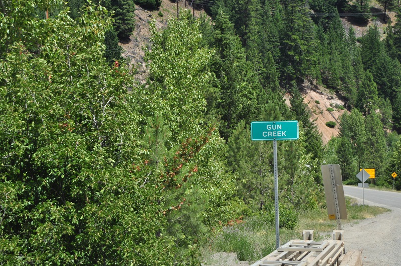 Gun Creek sign at the take out bridge. You can't miss it.
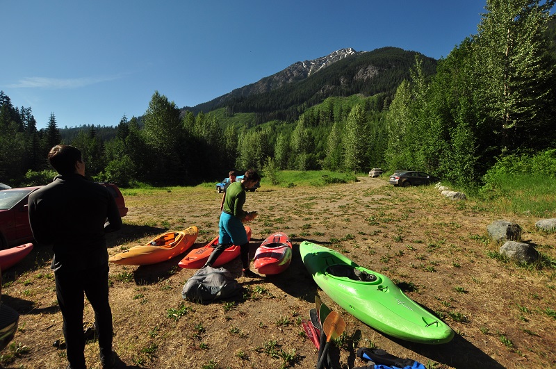 Gearing up at the Jewel Creek Trailhead. The put in is also the start of some fantastic multiday hiking in the South Chilcotin Mountains Provincial Park.
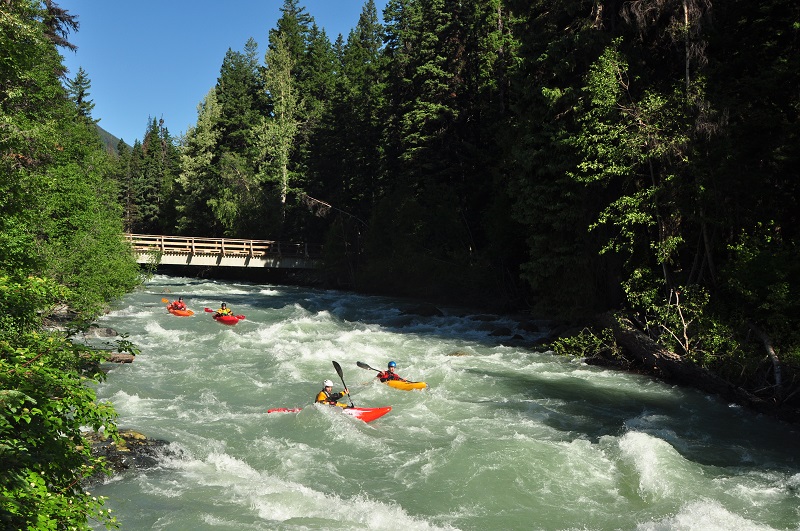 First whitewater. No breaks until the take out.
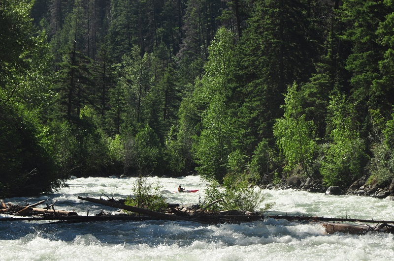 This picture sums up Gun Creek well. Continuous, splashy, not many good eddys, forest to the river bank and wood in the river.
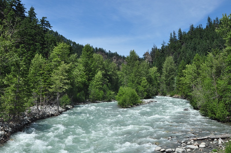 Gun Creek from the take out. This is a medium flow.
Updated October 1, 2017

