Vitals
- Locale: Whistler/Pemberton, British Columbia
- What It's Like: Continuous boulder rapids studded with some classic bedrock drops.
- Class: Continuous class IV-V, class V at higher levels.
- Scouting/Portaging: Easy to moderate.
- Level: Visual. There is an online gauge that is intermittently active. Look for a 20 cms difference between the total flow and diverted flow for a good medium level..
- Time: 3-4 hours.
- When To Go: Whistler high water season - quite a bit of water needs to go over the dam to give good flows.
- Info From: Many visits.
- Other Beta: None.
- Map: Click here for a map of the river zone.


Description
Rutherford Creek is a Sea To Sky classic that has unfortunately fallen from the limelight in recent years. Miles of continuous boulder rapids and a handful of quality bedrock drops including a perfect 20 footer make this a river not to be missed. It is a challenging run and it is very testing at high levels. Part of its allure is the difficulty in finding it with a good flow - if you get there and it's running, put on and don't miss out.
The Rutherford has a tragic history. It was one of the first classic whitewater runs in Squamish-Whistler to become the victim of a run-of-river hydro project. A 9 km long diversion tunnel now drains the river of all its water for the majority of the year - it can now only be run at the height of the summer when the diversion is overwhelmed. In exchange for losing natural flow, the local kayak community negotiated the construction of an artificial whitewater course below the powerhouse. However, it is of little consolation as it seems to only get used by slalom boaters once or twice a year - far fewer days then the river was runnable prior to the dam.
The take out for the Rutherford is found where the river runs under the highway 99 bridge just west of Pemberton. You'll see the powerhouse for the hydro project and the artificial course on the downstream side of the road. The access road for the river is on the river left side, and it is well marked as the Rutherford Creek Forest Service Road. There is ample parking just as you turn onto the Forest Service road near the rail bridge.
The most commonly paddled sections of the Rutherford are found below the diversion dam. There are convenient km markers along the dirt road up the river - the access points are where the river runs close to the road. The first put in is at km 3 - this is the split between the upper and lower halves of the run. Starting at the 7 km road marker is ideal - all you have to do is bash through 50 meters of bushes to get to the water. You can also just start at the dam a few km further up stream. Doing the whole thing is recommended - the half way access is a good bail out point if you want off the river.
Prior to the construction of the dam, the Rutherford ran at good levels for a long window during the summer months. Currently it is only possible to boat the Rutherford during times of peak snowmelt, which is often limited to the first hot weather of the summer in June when there is still a lot of snow in the mountains. You can easily check out how much water is in the river at the take out, but there is not a great visual gauge. There is an online gauge provided by the power company that is usually functional. 20 cms in the river below the dam is medium.
Once on the water, the river starts off with some class IV continuous boulder rapids. Much of the river can easily be boat scouted - get out and look where necessary. After passing the clean 20 footer carefully run the next short section and stop above a towering horizion line - there is no pool above this drop. This is a marginal 40 foot waterfall with another bad rapid below - both can be portaged with some bushwhacking on river right.
After the portage come several bedrock drops and a couple of steeper boulder sections, and all to quickly you'll arrive at the half-way access point. From here down it's almost exclusively continuous boulder rapids. The highlight of this stretch is a big triple drop - it's easy to recognize from the horizon line. The lower half is generally more challenging than the upper stretch.
Be on the lookout now for the second near mandatory portage - as with the first there isn't much slack above it - it has been run both intentionally and unintentionally. Portage this on the right as well. Not far below this last big drop the bridge will come into sight and you can celebrate having successfully descended the Rutherford!
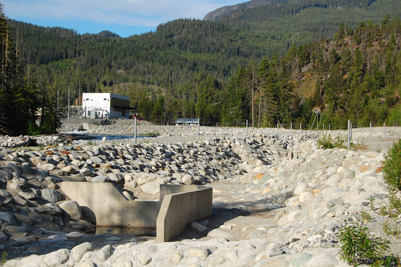 The powerhouse and dry whitewater course on the Rutherford.
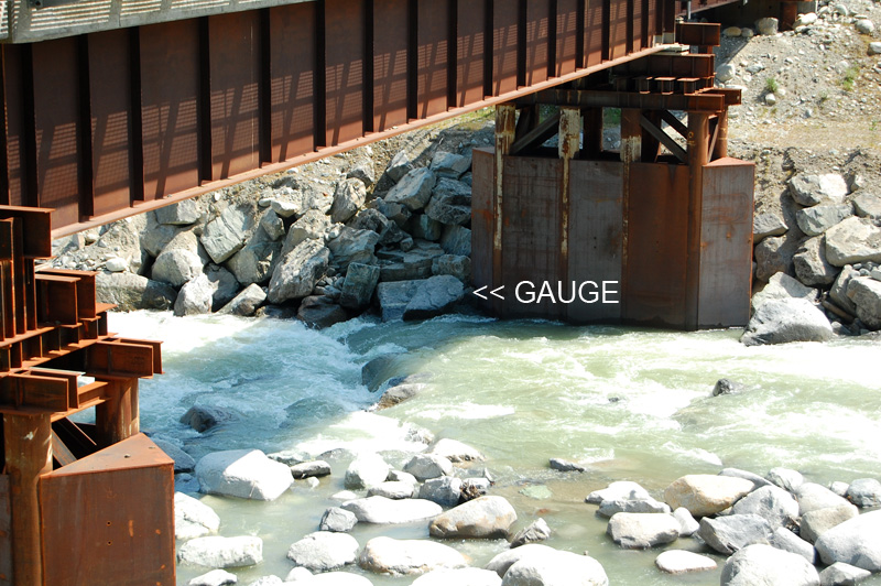 An out of date visual gauge - this is a low flow for the Rutherford.
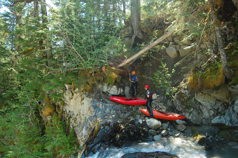
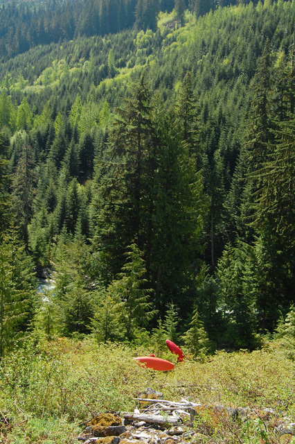 The short bushwhack to the water.
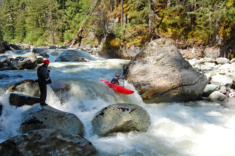
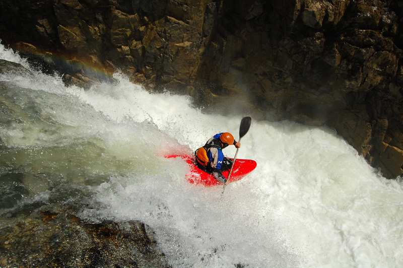 Matt on the nice 20 foot drop near the top.
 The top of the portage around the 40 footer.
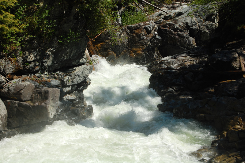 The horrible rapid below the waterfall that for most will mandate the portage.
 A bedrock rapid found on the Rutherford.
 A standard boulder rapid.
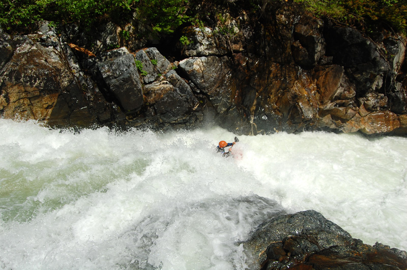
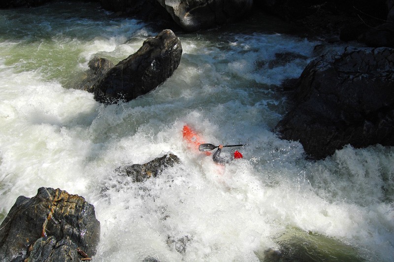
 Crux of the triple drop.
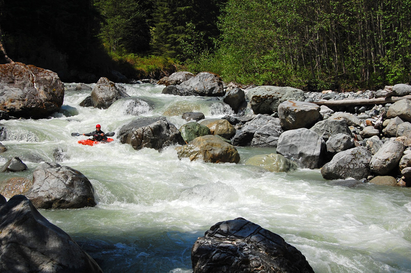
 One of the last rapids on the river - a good way to end the day.
Updated June 22, 2010

