Vitals
- Locale: Fraser Valley, British Columbia
- What It's Like: Short but high quality, creamy smooth granite bedrock and boulders deep in the Fraser Valley.
- Class: V at medium levels.
- Scouting/Portaging: Difficult.
- Level: Visual only.
- Time: 2-3 hours + possible hike in.
- When To Go: After rainfall or snowmelt in early summer.
- Info From: Feb 2011.
- Other Beta: None.
- Map: Click here for a map of the river.


Description
The Statlu Canyon is a classic class V run found in the very southern tip of the Coast Mountains deep in the Fraser Valley. Building from easy rapids to surging class V and back over its short length, the clear green water and smooth granite combine to give a stretch of river that is rivals most of the other class V runs in the area. Reminiscent of the Bottom Mile of the Ashlu with less gradient and higher volume, this section remains relatively unknown despite being above the popular intermediate stretch of the Statlu/Chehalis. Unfortunately this run is yet another that is under the direct threat of a hydro project which will forever change its wild and beautiful character.
The Statlu is a tributary of the Chehalis River. The Chehalis flows into the north side of the Fraser River between the towns of Mission and Harrison Hot Springs. A major logging road ascends the west side of the Chehalis valley - it is well signed for Chehalis Lake where the logging road leaves highway 7. About 15 km up the logging road is a bridge over the Statlu, which is the lowest possible take out for the Canyon.
The put in is at the third bridge over the Statlu, 5 km up the Statlu logging road. The third to second bridge section is where the hard whitewater is found. Bridge two to bridge one is essentially an extension of the easier lower Statlu run. Unfortunately the road is often gated just past the first bridge, meaning a 1.5 hour walk to the third bridge put in and paddling out to the first bridge where the cars are parked.
The level of the Statlu is visual only. The upstream river left bridge piling at the first Statlu bridge can be used as a visual gauge - 5.5 units showing equates to a perfect medium level. Expect the Statlu to run after rainfall - it should also have a short snowmelt season in early summer. This report was compiled 24 h after a moderate winter rain event with the following gauge peaks: Chilliwack River above Slesse 1.7m, Alouette River 0.95m, Coquihalla River 2.8m and Stave River 23 cms.
The Statlu Canyon starts off as easy but scenic class II-III from the put in bridge. The only indication of the gradient downstream is the very steep shuttle road you drive/hike on the way up there. Things build quickly and you will soon be at the start of the hard whitewater. The rapids are generally blind from above, necessitating bank scouting - portaging is possible but difficult. After a couple of big bouldery rapids the canyon briefly opens up before dropping over the final two rapids.
The last two big rapids are set in an incredible location with enormous boulders and colossal log jams lining the banks. The second last rapid is a stand-out double drop that is difficult to scout - it is well worth the effort to do it though. The last rapid is a burly 20 foot waterfall with an easy portage on the left. Below here it is quality class IV, easing to class III just above the second bridge that will be the take out if you can drive the shuttle.
 The parking lot for the Statlu if the gate is closed.
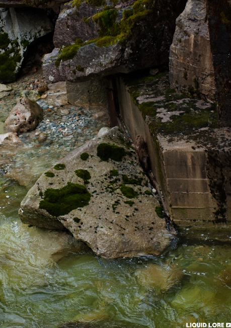 Convenient gauge, upstream river left of 1st Statlu bridge. 5 1/2 units showing = perfect medium.
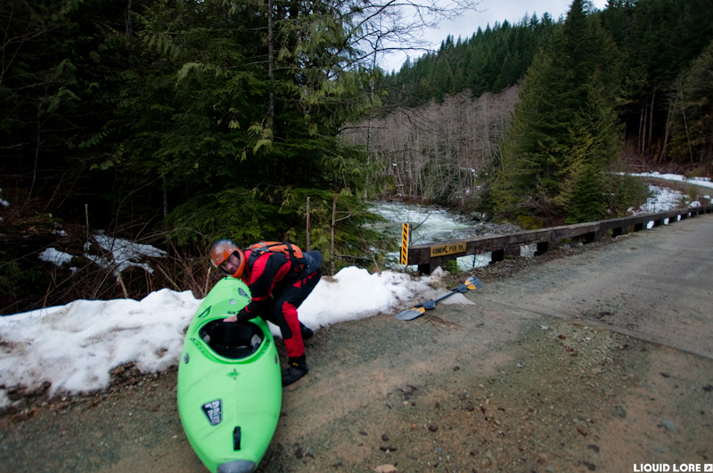 Getting ready at the put in.
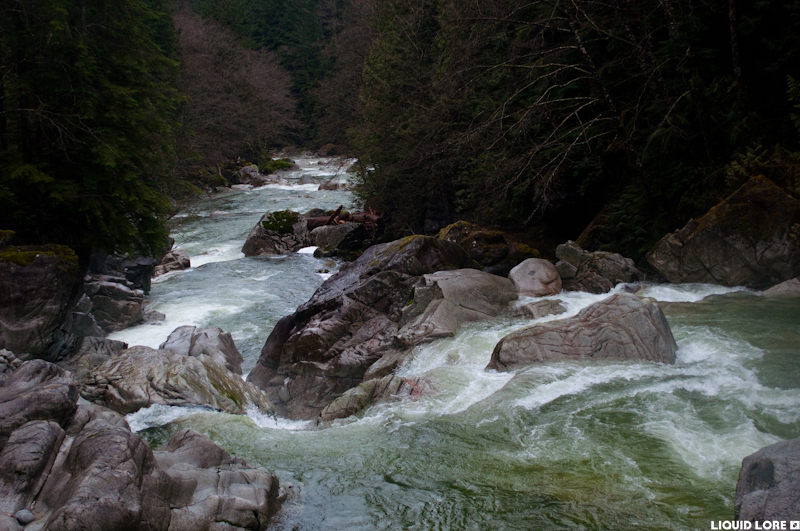
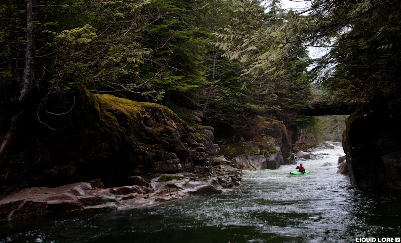 Nice scenery at the start of the canyon. That is not a bridge, it is a log spanning the river in the background.
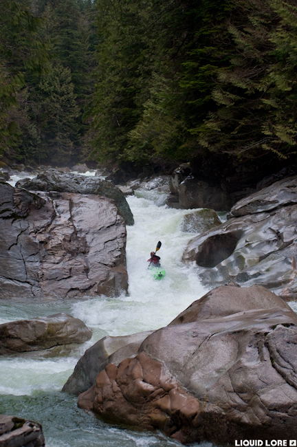 The first big one - ramp into a hole.
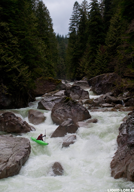 In the meat of the run.
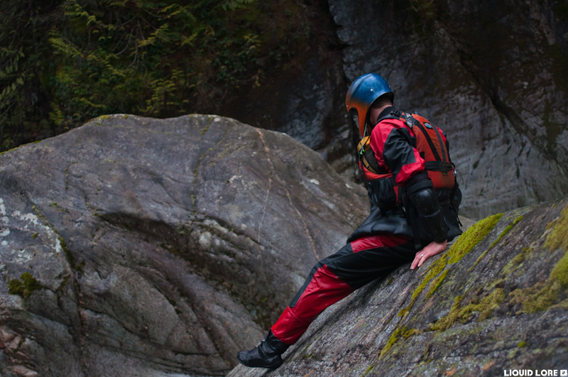 Scouting the exit drops.
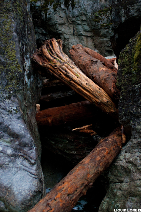 Log jam at the exit of the canyon, not in play.
 Looking down on the last major drop - a 20 foot constricted waterfall.
Updated Feb 10, 2011

