Vitals
- Locale: Near Placerville, California.
- What It's Like: A low elevation Sierra granite day trip. Good whitewater, but some tedious aspects.
- Class: V
- Scouting/Portaging: Moderate. Some gnarly spots have tricky river level portages.
- Level: Online gauge: Upper Middle Cosumnes
- Time: Solid 4 hours without a guide.
- When To Go: Early season snowmelt, winter rains.
- Info From: June 2011 at 275 cfs.
- Other Beta: Darin McQuoid and A Wet State.
- Map: Click here for a map of the river zone.


Description
This page was last updated in February 2012 and it is not regularly maintained. Information may be inaccurate.
The Middle Cosumnes River is a small drainage found just a short distance south of Placerville and the extensive South American River system. A relatively low elevation river, the Middle Cosumnes contains a short but typical section of California class V granite that can be run in the winter after rain or during a brief window of spring snowmelt. While we wouldn't consider this a classic when measured against other class V day trips in the state such as the East Kaweah, Big Kimshew and the South Branch, it is a unique run worth putting in the effort to paddle.
The best information about appropriate flows and shuttle directions are found at Darin McQuoid's site and at A Wet State.
There is a convenient online gauge for the Upper Middle Cosumnes. 275 cfs is a low but doable level. Lower would not be worthwhile. Higher than 500 cfs is reported to be spicy. The shuttle on this run (as of 2011) is quite long and convoluted relative to the length of the good whitewater, and it is one of the rivers' main detractors. Expect a long journey from one side of the river to the other on poorly marked side roads, and a rough drive down in to the canyon to reach the take out. Check the above noted webpages for accurate directions. Access may change in the future.
From the river right put in near Dog Town Creek at the end of forest road 9N60 you will find about a mile of brushy riverbed above the start of the good whitewater. The granite heart of the Upper Middle Cosumnes starts with a portage, then a series of slides where a creek cascades into the river on the left (the old put in, not accessible in 2011 due to landowner issues). There are several portages on this section that are just difficult enough to be annoying. Watch out for poison oak!
Be careful below the slides as there is a mandatory portage around large rapid called Tony Hawk that comes up quickly. The mile of whitewater below here is a great mixture of granite bedrock and complex boulder rapids. If you don't have a guide, it will take a few hours to sort your way through but it can all be dealt with at river level. The largest rapid of the run called Skate Park comes about 3/4 of the way through this section. Eventually the granite will disappear and you will be faced with a few miles of class III boating to reach the take out, and a few bedrock surprises to keep you on your toes.
The river left take out is at a prospector's camp. The owner is friendly, but make sure to ask permission and scout the take out beforehand.
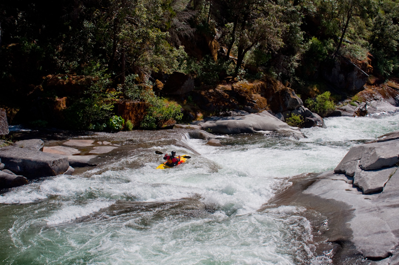
 One of the first decent bedrock rapids on the run, but still on the paddle in.
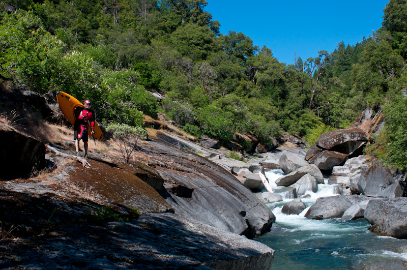 The good stuff starts with a portage.
 Small slides near the start of the good section.
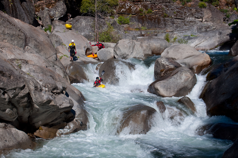
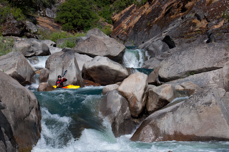 Typical UMC - granite boulders interspersed with nice bedrock. The double drop in the backgroud is very nice.
 A portage around a pile of rocks - probably runnable with more water.
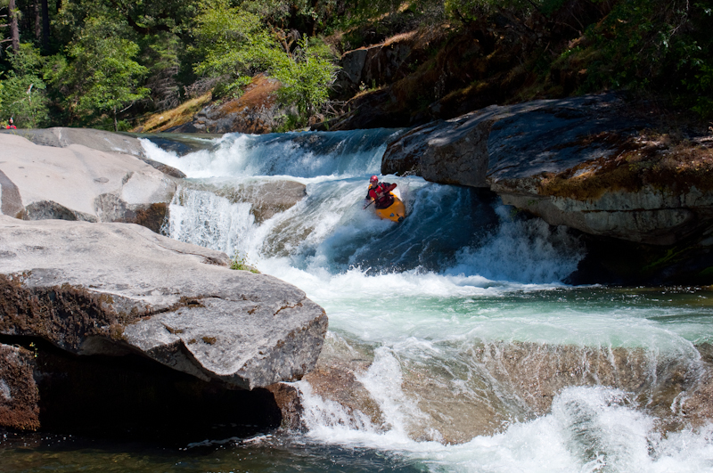
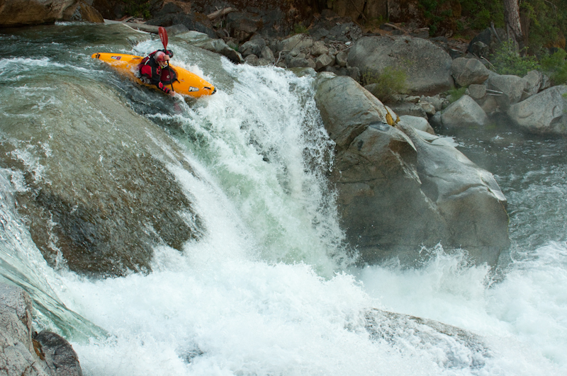
 Skate Park - about half of the rapid.
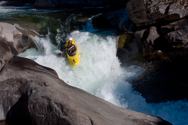
 Lars Holbecks.
Updated Feb 20, 2012

